

Home . GPS . Download . Business . Partners . Contact . Family . AVL . Links . History . AsOnTV . Holidays . Snoopy
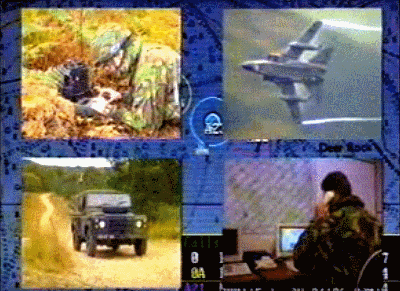
The military origin of Robin's GPS Software is on the Barossa Operation Page. Play the 1992 Barossa Operation Video.


Home . GPS . Download . Business . Partners . Contact . Family . AVL . Links . History . AsOnTV . Holidays . Snoopy
The military origin of Robin's GPS Software is on the Barossa Operation Page. Play the 1992 Barossa Operation Video.

 Hi ! This page was originally set up in 1997, but
it sometimes needs an update. You will see I've not changed much below for years.
It provides you with the broad history of the GPSS
product, launched in 1995, and some "Ancient History" - mostly relating
to myself, dating from the 1960s. Some of the "ancient" software,
designed or written by me in the past, pioneered some of the concepts
- and in some
cases the algorthims - used within GPSS.
Note that the last time I was employed as a programmer/analyst was 1971 :-)
After that my "day jobs" were ten years as a NATO scientist, followed by
14 years of management within
UK Defence Industry.
This page concludes with our Sunninghill business
strategy, that has not changed significantly since the business
started in 1994. This page should be of some value to those opening a business
discussion with me, since it explains "where I'm coming from".
Those words above don't need to be changed, but having reached 65 in 2012, I told the UK Taxman that I've retired, so I'm not taking money off anyone. June says I retired 10 years before that anyway ! I hope to continue for years yet, maintaining this web site and GPSS for those who use it. The procedures for people reaching the stage of using GPSS will remain the same, but you will not need to pay me anything :-)
 Robin Lovelock, Sunninghill, UK. January 2013.
p.s. Those who have used my GPS Software in it's unregistered state, will have seen Snoopy driving across their screens. This
has been going on since 1995. If you have browsed my hobby pages, including
aerial photography, aerial filming of
Red Kites, throwing
GPS bottles in the sea, or - more recently,
Trans-Atlantic
Robot Boats, you will have been struck by
how prominently Snoopy appears in these pages.
Perhaps I should explain now when I first met Snoopy, face-to-face, way back in 1971, in Holland.
I was about to start work as a NATO scientist with what was called then "SHAPE Technical Centre", and now, "NC3A".
Someone (who is now an old friend, and shall remain nameless to protect the guilty) sat me down at their
Computing Division's big computer. I think it was a CDC6600. It was part of their demonstration of their facilities,
and they set it playing Chess against me. In the middle of my game, who should appear but Snoopy ? - wearing flying helmet,
googles, and sat upon his kennel with wings - if I remember correctly. He did not distract me from my game of chess, but I still lost!
Even older memories of much older computers are at the bottom of this page. Maybe much more interesting than GPS Software :-)
Here are a few milestones in the career of Robin and the evolution of GPSS:
Robin graduated in 1969 with a B.Sc in Electronics Engineering, sponsored by Ferranti the Defence Contractor. He had already specialised in real time computer systems, and as a student had been particularly interested in artificial intelligence and pattern recognition. The biggest influence at that time was HAL, the gently speaking computer, in Kubrick's film, '2001 a Space Oddesy', and the original book by Arthur C Clark.
At Ferranti he worked on communications and radar tracking software which saw action over ten years later in the Falkland's War between the UK and Argentina. He then spent ten years working as a scientist (although he still regarded himself as an engineer) at an overseas NATO research establishment. A significant proportion of time was spent in the Laboratory on software which demonstrated concepts to the military, including the use of mapping on colour raster displays - which were new at that time. Robin had the priveledge of managing the design and implementation of a PDP11 based system used by SACEUR in the SHAPE bunker. (the existance of this system is not classified and was presented at a conference several years later in 1980). Many of the basic map display facilities in GPSS could be seen in this system. SHEWS, the SHAPE Early Warning System, took real time information from the chain of Air Defence radars sites strung from Northern Norway to Easter Turkey, and presented this information on touch-interactive colour raster displays. The system went operational in 1976, and it may still be working now.
 Robin returned to the UK and was recruited by the Directors of EASAMS, the Systems House of
GEC-Marconi, to assist them move into the Command and Control business. At
that time they were a studies and avionics systems house, having done all
the design and software for the Tornado fighter aircraft. In 1981 Robin began
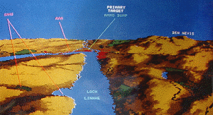
demonstrations of EAMACS, a software based mapping system which included use of
terrain elevation data to solve military problems like where to deploy forces.
Within ten years EASAMS had won two 100 million pound C3 contracts, which
Robin contributed to winning and implementing. One included similar map
facilities on UNIX platforms, for a country in the far east - against stiff
American competition. The other was the ADCIS system for the British Army
- a mobile network of some 1000 rugged VAX and PC computers mounted in
vehicles and networked by radio.
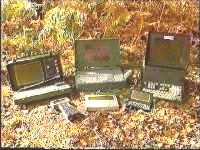 During the last five years of the 13 years within GEC-Marconi, Robin became
particularly interested in GPS, PC Computers, and Commercial Off The Shelf
(COTS) products such as Microsoft software, speech recognition and synthesis.
The Lovelock household got its first 386 PC in January 92, and early that
year Robin was demonstating a DOS based application which included GPS, mapping,
speech output, and use of terrain models.
Robin liked the odd bit of
programming to get his hands dirty, even when his job back in the office
involved management or business development.
 Some of his software was used
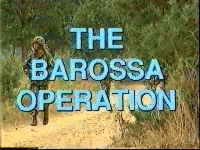
to support exhibitions and promotional videos such as "
The Barosa Operation".
This video, released in late 1992, shows the technology being used in an
Army context - GPS/PC/Radio equipment was mounted in three vehicles and on
the backs of two infantry soldiers. All five systems communicated by radio
and demonstrated how GPS, communications, map display and text-to-speech
software could be exploited. This DOS software evolved into the SSDEMO
product which was used as a demonstrator by Sunninghill Systems.
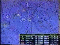 SSDEMO was a DOS application which received GPS data in standard NMEA or
proprietory Trimble TCIP format on a coms port. It displayed the information
on maps, of typically 1:50,000 scale detail, and spoke using the Soundblaster
text-to-speech software distributed with their sound cards. It included
vehicle navigation facilities capable of being used 'on the ground' or
'near the ground' in an attack helicopter. It supported radio communications
via a second COM port on the PC which would be connected to a radio modem.
Position, bearing and free text messages could be exchanged over the radio,
using a time-slot protocol whose timing was synchronised from the GPS data.
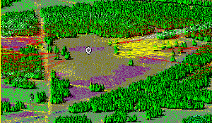 The units were tracked on the map, and received free text messages were
automatically spoken. Terrain models, holding height and type of vegatation
every 10 metres, could be used to demonstrate terrain screening and/or
route planning across ground. i.e. a similar calculation to that done
in the Microsoft Autoroute Express, but without the luxury of someone
having provided a road network. i.e. the vehicles (or men) might follow roads,
paths, or simply cut through the undergrowth. The criterea for the route
might also be based on not being seen from somewhere - not just minimum time.
SSDEMO was supplied in its basic form, with 1:50,000 scale mapping and text-to-speech, to BT Laboratories for their mobile system demonstrator. At their request, it was upgraded by Sunninghill Systems to use recorded speech - since the BT Chairman (and most other audiences) did not like the voice produced by the FirstByte text-to-speech (TTS) software (which was ahead of its time). June Lovelock's voice was used to replace the TTS.
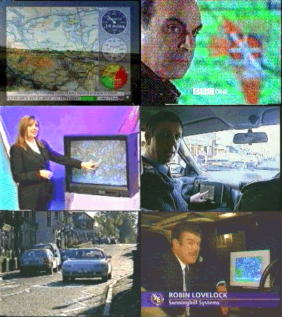
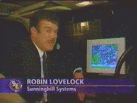 SSDEMO appeared in many forms until its first appearance on
UK Television
running in a Lexus Soarer on 5th May 1995. It was only delivered to EASAMS
and BT, although it was used at military exhibitions by RACAL. By May 1995
the new, Windows based GPSS product was in development and appeared briefly
on the 5th May TV programme with recorded speech, speaking English and
French.
The reason for GPSS being a Windows application was primarily to enable COTS voice recognition products to be exploited. By early 1995, Robin had decided what his business strategy and software product should be. The strategy was to issue a basic, free version of the software direct to the public, and collaborate even-handedly with any business opening up the market for GPS-based car navigation. He would stick to only software - so that he did not pose any threat to any business making use of the software. e.g. he would not offer the public GPS receivers with his software bundled in - it was up to other businesses to do that if they wished. In the same way, GPSS does not include a route planning capability - but it does offer the means of importing route guidance information from other software.
The main features of the first version of GPSS released in the summer of 1995 were : speech output in English and Japanese to describe where you were, and provide guidance to places. Ability to work with any scale of mapping, chosen according to what was available and what was good value for money.
Here is a simple summary of the main up-issues of GPSS.
The first (floppy disk) 'country disks' of maps and sounds for places outside the UK were released in October '96. GPSS was supplied and used used in several places around the World including the USA, Japan, Korea, Australia, Africa and parts of Europe. But things 'really started to happen' when the software itself was put onto this Internet web site.
In February '97, the first copies of GPSS were released from this Web Site onto the Internet, followed rapidly with maps and sounds for many countries in response to e-mailed requests. The maps were mostly samples from the 'country' disks already delivered (Sunninghill Systems only prepared new country disks in response to the first request or order received from that country. This process normally took no more than 24 hours).
In September 1997 GPSS was up and running 'on the road' connected to GPS in over 54 countries. By the end of 2000 this had reached a total of 138 countries., all of which were supported by free mapping which could be downloaded from the web site. "GPS Enthusiast" and "business" contacts in many of these countries had helped Robin with data, also available free on the web site, to make GPSS speak many other languages, including Russian and Dutch. In many countries the mapping would go down to street level, with permission from the holder of the copyright, and help in GPS calibration from local contacts.
In early 2001, GPSS version 5 was made available free on the web site, together with street level mapping for the whole of the USA. All of the web site, including GPS Software, speech and mapping, is available on the "free" GPSS CDs pressed for duplication by business partners.
Sunninghill Systems intend GPSS to become the de-facto standard for the software used within future car-computer systems. Robin and June will then be happy to take a small licence fee from the many millions of car-computers running some future version of GPSS.
The philosophy is to continue offering the latest basic UK package at a low price of typically 20 pounds Sterling, plus additional countries at 30 pounds per country - with permission to distribute identical copies. Major up-issues of GPSS will be accompanied by release of the old issue to PC Magazines to distribute on their CD-ROMs, and onto the Net from this Web Site.
This is an effective way of making contacts with other businesses who can exploit GPSS to sell their hardware solutions (e.g. car-computers, Notebook PC, GPS receivers) or compatible software (e.g. voice recognition, route planning, or more detailed maps).
Sunninghill Systems will continue to form non-excusive arrangements with other companies such as GPS, PC Computer, Software or Car Navigation System suppliers to help them sell their products and promote the wider circulation of the GPSS software.
The main source of income for Sunninghill Systems has been provision of high-value configurations of GPSS to those that need and can afford them. One example is use for Inmarsat-C communications, where the licence per computer was 10,000 pounds - since the alternative would have been much more expensive. Sunninghill Systems are often funded to upgrade the GPSS product by someone who needs it to do something extra to meet their requirement. e.g. process messages received in a different format. These improvements to the product may remain 'hidden' (as for the Inmarsat-C logic), or become available to all. The cost of these early upgrades are all negotiable, depending upon the effort required to implement the change, and the likely increased value of the upgraded GPSS product.
In the Summer of '97 Sunninghill Systems signed a contract with GPS
Technologies, based in Singapore and Malaysia, for use of GPSS within
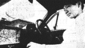 a new low cost car-computer
product aimed at the mass consumer market. More detail of this deal is
on the
news pages
of this site. This type of agreement can be repeated
many times over, for different parts of the world, and for different
market sectors. The nature of these contracts is permission to use the
software in exchange for an annual licence fee plus 1% of the total
sales revenue.
I've not changed any of the words above, since most remain as true today as when they were written. Unfortunately the business in Singapore was killed at birth by the Asian Recession, but it was always our strategy to "back many horses" and try to conduct business so that these horses (our business partners) do not "trip each other" :-) A quick browse through our business and partners pages will show that we have good reason to be "quietly confident" that we are slowly reaching our goal. These things take time :-)
Robin Lovelock, Sunninghill, UK. August 2001.
 from Robin in January 2013: I'll not change those words from many years ago, immediately above :-)
I recently found myself typing these words below, to another "old boy",
in the USA, who contacted me after hearing of my daft robot boat escapades.
It seemed a shame not to put them below, here on my "history" page - even if the history is a bit ancient !
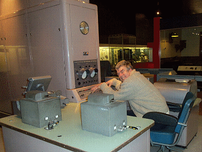
The picture on the right was taken at The Science Museum, London, when I attended a talk on ancient military computers,
by our old boss who I hadn't seen for over 40 years.
The good thing about growing old and losing marbles, is you get to hide your own easter eggs
I don't think I've put much on my pages, but my introduction to computers was a free programming course in the evenings, just after leaving school in early 1960s, on a local business set up by old boys with a 1950's Joe Lyon Leo 2/11. Huge, and with lots of valves and huge resistors, but they could make it play music.
Then, as you may see on www.gpss.co.uk/history.htm, Ferranti, a local defence contractor, recruited me as a student apprentice and sent me to University. During my final year project, I got to work on a Ferranti Pegasus computer, given to the Electronic Engineering department by the Maths one, who'd just got an ICL1900. Our Ferranti Librarian gave me the hard bound book for the Pegasus and I still have it here somewhere.
My project was interfacing an old communication tele typewriter to the Pegasus, and then programming it to do some "conversational computing". You Americans call itTic-Tac-Toe I think - which we call "noughts and crosses".
I remember reading then that the Pegasus first went into production by Ferranti in 1949, and it was based on the Manchester University Mk1. This in turn was designed by Alan Turing who went there after the war, and working at Bletchley Park on Colossus to break the German Enigma code.
I remember the Pegasus to have a "RAM" of 55 39-bit words. Each of these was a card, with a valve, circulating the 39 bits around a nickel delay line. It also had a rotating drum memory - which was massive - a capacity of KILO bytes !
You looked at memory contents with a 55 position rotating switch on the control panel, and an oscilloscope showing the selected train of 39 bits as pulses.
Occasionally the computer would crash, and the cause often turned to be a dirty edge connector on one of those 55 cards in the cabinet behind the control panel. You turned the rotary switch, until you saw a bit flickering. You then counted to that card, pulled it out, rubbed the edge connector with a rubber (sorry - I think you Americans call them "erasers") and put the card back in. It always "booted up" just fine.
In those days, the bootstrap was a process of putting in the right sequence of patterns on the switches at the front. I remembered doing this on the 1960s vintage military computers back at work, until the leap - forward in technology - a rotary switch that you turned to put in the sequence. All burnt into memory since then, of course.
I remember that the Pegasus had quite a lot of good software available in the 1960s, despite how austere the hardware was. Hardware has made amazing leaps and bounds since those early days, but in may ways, software has not advanced at all
The only changes to above, if any, is correction of typos. Enjoy! :-)
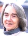 Extra footnoote in July 2013: There are a couple of typos I did not correct in that "Ancient History" above:
The SHAPE Early Warning System extended to Eastern Turkey, not to "Easter Turkey". I prefer the incorrect version :-)
Also, for the record, one of those £100 million contracts was in fact £1 billion, and included ships, aircraft,
civil engineering, and nation wide telecommunications. Thank you Maggie Thatcher, for helping us close the deal :-)
Yet another footnote added in March 2015: Relevant "ancient history", from a new "Froggy" page, casting light on Robin's earlier years in his defence systems career. This dates from when Robin was recruited as a student apprentice, by Ferranti. The "Froggy" page was added when publicity was needed, both sides of the Channel, to find Snoopy's robot boat. This publicity was no longer needed after the Royal Marines (allegedly), did a "covert rescue", and Snoopy landed near Brighton Pier. Robin then continued to use any Press/TV/Radio interest, to promote his "NHSCare Coughlan Campaign Group" web site www.nhscare.info This was with the intention of "Coughlan" being common knowledge before the day of the UK General Election, on 7th May 2015.
(Preceeded by French, kindly provided by Yves, the French Professor who dreamt up the Microtransat Challenge)
 I've had a long relationship, love, and respect, for the French, starting when I worked for NATO in the 1970s.
None of this is classified, and has been in the Public Domain for years, including papers read at International Conferences,
such as the one that I presented a paper on the NATO militaty system SHEWS, at The Hague, Netherlands, in 1981.
However, the more important information, such my late French friend George, has been on these pages for years.
These words may read like a C.V. but they are not: since I retired, I've been much too busy to do real work, so I certainly not seeking it, or anything that takes time away from my Snoopy hobby, or UK NHS Coughlan Campaign charity work on www.nhscare.info Also, if the content below seems a bit too "technology oriented", that's a reflection of me, but also of the type of person who contacts me about Snoopy.
From 1971 to 1980, I was employed as a NATO scientist, working at SHAPE Technical Centre in The Hague Netherlands, known then as STC. This place is now called NC3A, or the NATO Command, Control, and Communications Agency. STC was originally in Paris, but General De Gaule kicked them out in the early 1960s, when the French withdrew their military forces from under military command of what is always an American General, with the post of SACEUR - Supreme Allied Commander Europe. The top of the European Command structure is known as SHAPE (Supreme Allied Command Europe) and is now located in Belgium. STC took it's instructions from SHAPE, and that's when I worked on SHEWS, mentioned on my History page. I fondly remember, when I was tasked with delivering this system, having a formal meeting with French engineers, my opposite numbers, at one of the meeting rooms, in NATO Headquaters, Brussels. They spoke French, and I only spoke English - plus a tiny bit of Dutch - enough to ask for another beer. As we spoke, they in French, myself in English, sharing engineering diagrams, on the table, we understood each other perfectly. The interpreters, in their glass booth, chattered away, as best they could, to keep up, and we tried to ignore their words from our earphones. Eventually they probably stopped, when they saw we had taken the headphones off.

 The Lovelock Family returned to England in 1980,
and I began work with EASAMS (Elliot Automation Space and Advanced Military Systems)
and I helped, in my small way, of working with other colleages, to get very large
military contracts, including a Billion pound one in Malaysia, against stiff American competition.
This is also spoken of on my "History" page.
It was when working with French engineers in the 1990s,
that I discovered Paris was the loveliest city in the World.
It was then that, when collaborating with companies such as Dassault Electronique
(who did militarised laptop PCs), and Thompson CSF, and working closely with their
engineers ( Henry, are you still out there somewhere?), that I
fully understood my suspicion that they had a similar sense of humour as English Engineers.
e.g. They know we call them "Frogs", because they like to eat frogs. They call us "Roast Beef",
because we were stupid enough to eat it. I think that was before Mad Cow Desease ?
The technical stuff is mentioned in my "Barrosa" page, probably also linked from the "History" page,
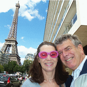 June and I had a lovely weekend in Paris, to celibrate our Ruby (40 year) Wedding Anniversary.
This appears in our
2011 Family Newsletter
and the detailed pictures have been on
www.gpss.co.uk/paris since then.
June and I were married, in Sunninghill Church, on 26th June, 1971, having met at Ferranti.
I knew Paris to be my favourite city - more even than London, where I went to City University,
in the late 1960s, employed as a Student Apprentice, with Ferranti, the UK Defence Contractor.
When, as a young Technical College boy, I went for an interview at Ferranti, in Bracknell, I thought they made racing cars (Ferrari). I discovered that they made military computers and systems, but - since they were paying for me to go to University - I did not mind.
That's how I got into defence systems, and met some of our best friends. One is Roy, who was in the March 2015 launch team. I was reliably informed, in later years, that June was given advice to seek work at Ferranti, as a young 17 year old, because there were a lot of eligable engineers there :-)
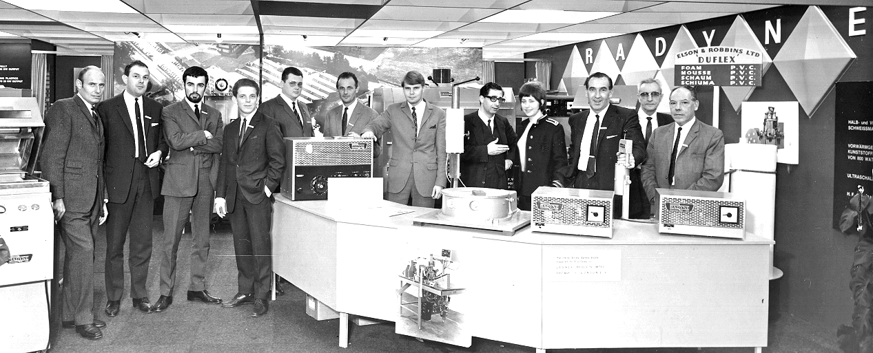
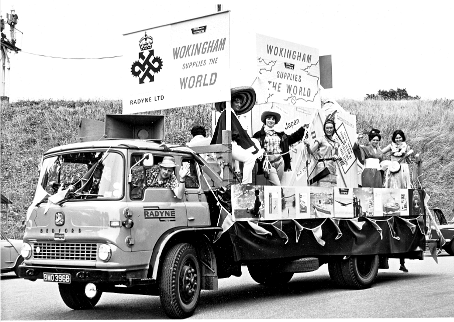
Recently discovered in my old emails: pictures from my days at RADYNE in Wokingham, fresh out of St Crispin's School, and before joing Ferranti. My dad Len Lovelock worked at Radyne, as did my uncle Ron Sharp. Radyne did pioneering work, exporting radio heating based equipment Wordlwide, such as for automated manufacture in the car industry. Mr Spindler, my metalwork master at St Crispins, suggested that I do an OND at High Wycombe Tech, which is where I met Lord Peter Carrington for the first time. The two 6 month industrial traing periods were at Radyne, the last being in their labs, where Uncle Ron was the Manager. I recognise that fresh-faced Sales Engineer in the centre, who taught me the discipline of using an Engineering Log Book - a habit I never lost. Where else could I put these photos and memories, but on this "History" page ? :-)
There have been
visits to this page since 3rd December 2015, counted by
Web Counter
.
![]()
![]()